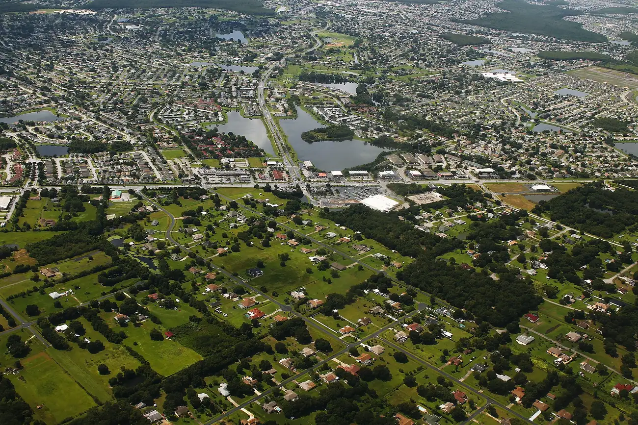
Kissimmee's Lakeside area, east of Florida's Turnpike, has about 2,840 homes, mostly in ZIP 34743, all zoned for Cypress Elementary and Gateway High.
Last checked Oct. 9, 2026. Sources: the City of Kissimmee’s Zoning and Future Land Use Atlas (mobility district, overlay, PUD and parcel layers) and parks directory, the School District of Osceola County’s 2026-27 attendance zones, the Florida Department of Education’s 2026 school grades, the federal NCES school directory, Zillow Research, LYNX and OpenStreetMap.
East of Florida’s Turnpike, Kissimmee’s city limits take in a ring of subdivisions around Lakeside Drive, Westlake Drive and Hilliard Isle Road. The city’s own name for the area shows up in its park, the Mark Durbin Community Park at Lakeside, and in two large planned unit developments on its map, Lakeside Estates, about 738 acres, and Hilliard Isle, about 885 acres. This page covers the area the city maps as Mobility District 7, about 1,860 acres.
The city’s parcel layer shows about 2,836 homes on 2,288 residential parcels: 80% single-family houses and 19% apartments. The median build year is 1998.
What this means for you
- High school: Gateway High School, for every home. It earned a B in Florida’s 2026 grades.
- Home value: $338,029 in ZIP 34743 in August 2026, according to the Zillow Home Value Index.
- Nearest highway exit: Florida’s Turnpike exit 244 (U.S. 192/441), about 2.8 miles by road.
Part of our Kissimmee neighborhoods guide.
Where it is
On the city’s map the area lies east of Florida’s Turnpike, with Simpson Road along much of its northern edge. Fortune Road runs along its southern part. The Mill Slough area is across the Turnpike to the west.
County plat records name its subdivisions, among them Whistlers Park at Lakeside, Cypress Lake, Flamingo Lakes, Emerald Pointe, Shannon Lakes, Remington Pointe, Morgan Point and Westlake Hammock. Cypress Elementary School, 2251 Lakeside Drive, is in the area, according to the federal NCES directory.
About 37% of the land is inside the city’s Short-Term Rental Overlay district on the zoning map. The overlay’s rules are in the city’s Land Development Code.
ZIP codes: 34743 for 81% of homes and 34744 for 19%.
Schools
From the district’s 2026-27 attendance zone files, matched to every residential parcel:
| Level | Zoned school | Share of homes | Florida 2026 grade |
|---|---|---|---|
| Elementary | Cypress Elementary | 100% | B |
| Middle | Denn John Middle | 100% | C |
| High | Gateway High | 100% | B |
Every home in the area shares the same three zoned schools. Confirm an address on the district’s school locator maps. More in our schools guide.
Home values
The typical home value in ZIP 34743 was $338,029 in August 2026, down 2.7% from $347,489 in August 2025. In ZIP 34744 it was $380,668, down 2.5%. Zillow’s Kissimmee figure was $355,971, down 3.2%. The Zillow Home Value Index is a modeled typical value for the middle third of homes, single-family houses and condos together, not a sale price, and it covers each whole ZIP code, much of which is outside the city. More in our home prices guide.
Parks and trails
- Mark Durbin Community Park at Lakeside, 2253 Lakeside Drive: roller hockey rink, skate park, playground and sports facilities.
- Fortune Road Athletic Complex, 2500 Fortune Road, just outside the area’s boundary: baseball and softball fields, a multipurpose field and a playground.
More in our parks and trails guide.
Getting around
- Turnpike: exit 244 (U.S. 192/441), about 2.8 miles by road; exit 249 (Osceola Parkway), about 4.8 miles.
- City Hall: about 4.8 miles.
- Orlando International Airport: about 10.3 miles, the shortest trip to the airport from any area in this guide.
- These are distances measured on the OpenStreetMap road network with the OSRM routing engine, not drive times.
- Bus: LYNX’s current schedule data lists route 10 (East U.S. 192/St. Cloud) and FastLink 407, which runs to Orlando International Airport, with stops in the area. Times are on LYNX’s route pages.
More in our getting around guide.
Groceries and everyday stores
OpenStreetMap maps a Publix at 2625 Simpson Road, Unidos Supermarket on Simpson Road and Key Food on Fortune Road in the area. The nearest pharmacies it maps are a Walgreens near East Osceola Parkway and Buenaventura Boulevard, about 3.6 miles by road from the middle of the area, and the CVS Pharmacy at 1999 E. Osceola Pkwy., about 3.9 miles.
How we drew this area
This page follows Mobility District 7 on the City of Kissimmee’s mobility district layer. The city gives the district a number, not a name; we call it Lakeside after the city’s Mark Durbin Community Park at Lakeside and the Lakeside Estates planned unit development inside it. Home counts, build years and ZIP codes come from the city’s parcel layer (Osceola County Property Appraiser records) on Oct. 9, 2026, matched to the School District of Osceola County’s 2026-27 attendance zone files. Store locations and road distances use © OpenStreetMap contributors.
Frequently asked questions
What schools are zoned for Lakeside in Kissimmee?
Cypress Elementary, Denn John Middle and Gateway High, for every home in the area in the 2026-27 zones. Cypress Elementary and Gateway High earned a B in Florida’s 2026 grades.
Is the Lakeside area of Kissimmee a good place to live?
Here are the facts. It has about 2,840 homes, 80% of them single-family houses, a median build year of 1998, a Publix and the Mark Durbin Community Park at Lakeside. It is the closest Kissimmee area in this guide to Orlando International Airport, and the typical home value in ZIP 34743 was $338,029 in August 2026, according to Zillow.
What ZIP code is Lakeside in Kissimmee?
34743 for 81% of homes and 34744 for the rest.
Where is Mark Durbin Community Park in Kissimmee?
At 2253 Lakeside Drive. It has a roller hockey rink, a skate park, a playground and sports facilities.
Have your say