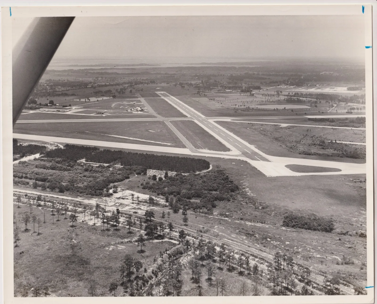
The Martin Luther King Jr. Boulevard area west of downtown Kissimmee has about 2,400 homes, Osceola High School and Kissimmee Gateway Airport.
Last checked Oct. 9, 2026. Sources: the City of Kissimmee’s Zoning and Future Land Use Atlas (mobility district, land use and parcel layers), its parks directory and 2040 Comprehensive Plan, the School District of Osceola County’s 2026-27 attendance zones, the Florida Department of Education’s 2026 school grades, the federal NCES school directory, Zillow Research, LYNX and OpenStreetMap.
West and southwest of downtown, Martin Luther King Jr. Boulevard runs from the downtown redevelopment area out past Thacker Avenue and Hoagland Boulevard. This page covers the homes along it and around Kissimmee Gateway Airport, the area the city maps as Mobility Districts 4, 9 and 10. Together they cover about 2,040 acres, much of it airport land.
The city’s parcel layer shows about 2,410 homes on 1,579 residential parcels. About 59% are single-family houses and 38% are apartments or other multifamily homes. Many are older: the median build year is 1972, and 356 parcels were built before 1960.
What this means for you
- High school: Osceola High School for 95% of homes (C in Florida’s 2026 grades); Liberty High for the rest.
- Home value: $284,955 in ZIP 34741 in August 2026, according to the Zillow Home Value Index.
- Nearest highway exit: Florida’s Turnpike exit 244 (U.S. 192/441), about 5.7 miles by road.
Part of our Kissimmee neighborhoods guide.
Where it is
The area sits between West Vine Street on the north and Clay Street and Jack Calhoun Drive on the south, from the downtown redevelopment area west to Hoagland Boulevard. Thacker Avenue and John Young Parkway cross it. It has three parts on the city’s map:
- District 9, between Vine Street and Martin Luther King Jr. Boulevard, includes part of the Orange Gardens streets and Oak Street Park.
- District 10, around Thacker Avenue west and south of downtown, has some of the city’s oldest residential plats, among them the Florida Land and Improvement Co. Addition.
- District 4 is mostly Kissimmee Gateway Airport, with streets of houses around it off Hoagland Boulevard.
In the 1940s the airport was Kissimmee Army Airfield. The city’s comprehensive plan names it one of the city’s activity centers and calls for expanding “business and industrial development opportunities within, and around” it. Its website is flykissimmee.com.
Two public schools are inside the area, according to the federal NCES directory: Osceola High School, 420 S. Thacker Ave., and Thacker Avenue Elementary for International Studies, 301 N. Thacker Ave.
ZIP code: 34741 for every home.
Schools
From the district’s 2026-27 attendance zone files, matched to every residential parcel:
| Level | Zoned school | Share of homes | Florida 2026 grade |
|---|---|---|---|
| Elementary | Thacker Avenue Elementary for International Studies | 93% | B |
| Elementary | Pleasant Hill Elementary | 7% | B |
| Middle | Kissimmee Middle | 94% | B |
| Middle | Horizon Middle | 4% | B |
| High | Osceola High | 95% | C |
| High | Liberty High | 5% | C |
The homes zoned for Pleasant Hill, Horizon and Liberty are at the south end near Jack Calhoun Drive. Check an address on the district’s school locator maps. More in our schools guide.
Home values
The typical home value in ZIP 34741 was $284,955 in August 2026, down 4.1% from $297,102 in August 2025, according to the Zillow Home Value Index. Zillow’s Kissimmee figure was $355,971, down 3.2%. The index is a modeled typical value for the middle third of homes, single-family houses and condos together, not a sale price, and it covers the whole ZIP code, not just this area. More in our home prices guide.
Parks and trails
- Oak Street Park and Community Center, 717 N. Palm Ave., with the Oak Street Park Sports Complex at 1500 W. Oak St.: playground, pavilion, tennis and pickleball courts, baseball fields and recreation programs.
- Lancaster Ranch Park, 1881 Jack Calhoun Drive, on the area’s southern edge: a new 150-acre city park opening in phases; Green Meadows Petting Farm, run by a private operator, has been open there since March 15, 2025.
Ladue Park and the Orange Gardens Community Center are just north of Vine Street. More in our parks and trails guide.
Getting around
- Turnpike: exit 244 (U.S. 192/441), about 5.7 miles by road; exit 249 (Osceola Parkway), about 6.1 miles.
- I-4: exit 64 (U.S. 192), about 9.6 miles.
- City Hall: about 1.1 miles. Orlando International Airport: about 17.5 miles.
- These are distances measured on the OpenStreetMap road network with the OSRM routing engine, not drive times.
- Train: the Kissimmee Intermodal station downtown, for SunRail and Amtrak, is about 1.3 miles by road.
- Bus: LYNX’s current schedule data lists route 26 (Pleasant Hill Road/Poinciana) and route 57 (John Young Parkway) with stops in the area. Times are on LYNX’s route pages.
More in our getting around guide.
Groceries and everyday stores
OpenStreetMap lists no supermarket or pharmacy well inside the area. The nearest it maps are Sedano’s, near North John Young Parkway and West Oak Street, and Kissimmee Meat & Produce, on West Orange Street, each about 1.2 miles by road from the middle of the area, and the CVS Pharmacy at 1205 W. Vine St., about 1.6 miles.
How we drew this area
This page combines Mobility Districts 4, 9 and 10 on the City of Kissimmee’s mobility district layer, minus the parts inside the downtown and Vine Street redevelopment areas. The city gives the districts numbers, not names; we call the area MLK Boulevard for the road that runs through all three. Home counts, build years and ZIP codes come from the city’s parcel layer (Osceola County Property Appraiser records) on Oct. 9, 2026, matched to the School District of Osceola County’s 2026-27 attendance zone files. Store locations and road distances use © OpenStreetMap contributors.
Frequently asked questions
What schools are near Martin Luther King Jr. Boulevard in Kissimmee?
Osceola High School, 420 S. Thacker Ave., and Thacker Avenue Elementary for International Studies, 301 N. Thacker Ave., are both in the area. In the 2026-27 zones, 95% of its homes are zoned for Osceola High.
Is the MLK Boulevard area of Kissimmee a good place to live?
Here are the facts. The area has about 2,400 homes, 59% of them single-family houses, a median build year of 1972, Oak Street Park and the city’s airport. It is zoned mostly for Thacker Avenue Elementary (B in 2026), and the typical home value in ZIP 34741 was $284,955 in August 2026, according to Zillow.
What ZIP code is the Kissimmee Gateway Airport area?
34741, for every home in this area.
Where is Kissimmee Gateway Airport?
On the city’s west side, along Hoagland Boulevard between Vine Street and Jack Calhoun Drive. In the 1940s it was Kissimmee Army Airfield.
Have your say