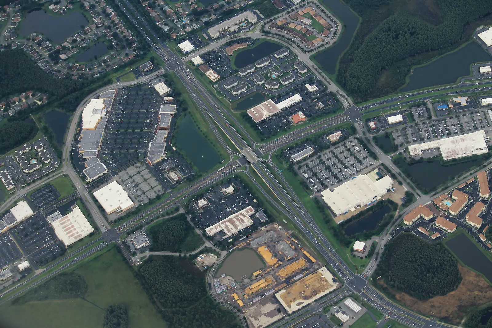
Flora Ridge is a mixed-use land use district south of Osceola Parkway with about 3,860 homes, zoned for Kissimmee Middle and Osceola High schools.
Last checked Oct. 9, 2026. Sources: the City of Kissimmee’s 2040 Comprehensive Plan (Policy 1.2.10.4) and Zoning and Future Land Use Atlas (land use, PUD and parcel layers), the School District of Osceola County’s 2026-27 attendance zones, the Florida Department of Education’s 2026 school grades, Zillow Research, LYNX and OpenStreetMap.
Flora Ridge is a mixed-use district on Kissimmee’s future land use map. The city’s comprehensive plan describes the Flora Ridge development as about 1,134 acres, about 70 of them wetlands, planned for homes, shops, offices, hotels, an industrial park and a public school. Its caps include 1,574 single-family homes, 2,525 apartments or other multifamily homes, about 1.5 million square feet of retail space and 675 hotel rooms.
On the city’s current future land use layer the Flora Ridge (MU-FR) district covers about 935 acres. The city’s parcel layer shows about 3,858 homes there on 2,432 residential parcels: 55% single-family houses, 37% apartments or other multifamily homes and 8% condos. The median build year is 2005.
What this means for you
- High school: Osceola High School, for every home. It earned a C in Florida’s 2026 grades.
- Home value: $284,955 in ZIP 34741 in August 2026, according to the Zillow Home Value Index.
- Nearest highway exit: the SR 417 toll road’s exit 10 (John Young Parkway), about 3.8 miles by road; Florida’s Turnpike exit 249 (Osceola Parkway), about 4.6 miles.
Part of our Kissimmee neighborhoods guide.
Where it is
On the city’s map the district runs along the south side of West Osceola Parkway, with Thacker Avenue and John Young Parkway on its east side and Carroll Street and Flora Boulevard on its south side. Dyer Boulevard and Ball Park Road run through it. Tapestry is to the southwest and the North John Young Parkway area to the south.
The city’s planned unit development layer names several projects inside it, among them the Flora Ridge PUD, Epoch, the Square at Osceola Parkway, Loop West, Stonefield, Eagles Reserve and Weston Reserve. Flora Ridge Elementary School, 2900 Dyer Blvd., is in the district.
ZIP code: 34741 for every home.
Schools
From the district’s 2026-27 attendance zone files, matched to every residential parcel:
| Level | Zoned school | Share of homes | Florida 2026 grade |
|---|---|---|---|
| Elementary | Flora Ridge Elementary | 77% | C |
| Elementary | Central Avenue Elementary | 23% | C |
| Middle | Kissimmee Middle | 100% | B |
| High | Osceola High | 100% | C |
The elementary zones split the district, so check an address on the district’s school locator maps. Osceola Science Charter School, a K-8 charter at 2849 N. John Young Pkwy. in the neighboring North John Young Parkway area, earned an A in 2026. More in our schools guide.
Home values
The typical home value in ZIP 34741 was $284,955 in August 2026, down 4.1% from $297,102 in August 2025, according to the Zillow Home Value Index. Zillow’s Kissimmee figure was $355,971, down 3.2%. The index is a modeled typical value for the middle third of homes, single-family houses and condos together, not a sale price, and it covers the whole ZIP code, most of which is older housing nearer downtown. More in our home prices guide.
Parks and trails
No park in the city’s parks listings is inside the district. The nearest is Osceola County’s Shingle Creek Regional Park, whose Babb Road entrance at 2491 Babb Road is about 1.9 miles away in a straight line; it has trails, kayak access and historic homestead buildings. More in our parks and trails guide.
Getting around
- SR 417: exit 10 (John Young Parkway), about 3.8 miles by road. SR 417 is a toll road.
- Turnpike: exit 249 (Osceola Parkway), about 4.6 miles.
- I-4: exit 64 (U.S. 192), about 7.7 miles.
- City Hall: about 5.3 miles. Orlando International Airport: about 15.6 miles.
- These are distances measured on the OpenStreetMap road network with the OSRM routing engine, not drive times.
- Bus: LYNX’s current schedule data shows no stops inside the district. The nearest are on North John Young Parkway at Ball Park Road, about a mile from its middle, served by route 57. Times are on LYNX’s route pages.
More in our getting around guide.
Groceries and everyday stores
OpenStreetMap maps a Publix at 3040 Dyer Blvd. and a Walgreens at Thacker Avenue and West Osceola Parkway inside the district. A CVS Pharmacy on North John Young Parkway near Osceola Parkway is about 2 miles by road from its middle.
How we drew this area
This page follows the Flora Ridge (MU-FR) polygon on the city’s future land use layer. Home counts, build years and ZIP codes come from the city’s parcel layer (Osceola County Property Appraiser records) on Oct. 9, 2026, matched to the School District of Osceola County’s 2026-27 attendance zone files. Store locations and road distances use © OpenStreetMap contributors.
Frequently asked questions
Where is Flora Ridge in Kissimmee?
In north Kissimmee, south of West Osceola Parkway, with Thacker Avenue and John Young Parkway on its east side and Carroll Street and Flora Boulevard on its south side. Dyer Boulevard and Ball Park Road run through it.
What schools are zoned for Flora Ridge?
In the 2026-27 zones, 77% of homes are zoned for Flora Ridge Elementary and 23% for Central Avenue Elementary. All are zoned for Kissimmee Middle and Osceola High.
Is Flora Ridge in Kissimmee a good place to live?
Here are the facts. Flora Ridge has about 3,860 homes, 55% of them single-family houses, a Publix and a Walgreens, and no city park inside. It is zoned for Osceola High (C in Florida’s 2026 grades), and the typical home value in ZIP 34741 was $284,955 in August 2026, according to Zillow.
What ZIP code is Flora Ridge Kissimmee?
34741, for every home in the district.
Have your say